fresh bytes
Subscribe Now

3D print your neighborhood from Google Earth using still shots and photogrammetry

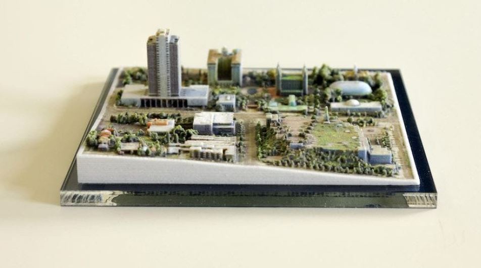
We’ve all used Google Earth to find our house and walk around the local area in virtual. But, a clever Redditer has taken this one step further and used a full-color 3D printer to create cityscapes directly from Google Earth.

If you’re not familiar with Google Earth, it’s a free computer program. It uses images from satellites to render accurate virtual representations of our planet in 3D. However, the images are inaccessible to download yourself.

Reddit contributor “amishrefugee” posted: “Coworkers and I figured out how to make full-color powder prints of chunks of Google Earth.”

By using photogrammetry, they were able to use Google Earth’s images as easily as if they were operating a drone. read more at All3DP.com

Leave a Reply

featured blogs
Jan 22, 2025
Shouldn't Matter mean I can eliminate all my other smart home apps? Almost. When it comes to smart home apps, review what device types might need an app....
Feb 5, 2025
Return of Rock ranks Telegraph Road as 5th among Dire Straits' best songs, describing it as "A fourteen-minute masterpiece worth every second of its length'...

featured chalk talk

Outgassing: The Hidden Danger in Harsh Environments
In this episode of Chalk Talk, Amelia Dalton and Scott Miller from Cinch Connectivity chat about the what, where, and how of outgassing in space applications. They explore a variety of issues that can be caused by outgassing in these applications and how you can mitigate outgassing in space applications with Cinch Connectivity interconnect solutions. 
May 7, 2024
39,348 views