

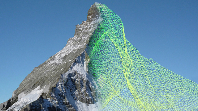
The lightweight autonomous ebees drones, developed by a company called senseFly, each spent about six hours circling the Matterhorn and photographing it from every possible angle. The fruits of their airborne labor was a collection of over 2,000 high-res photographs that were then used by a company called Pix4D to analyze and construct an incredibly detailed model of the Matterhorn composed of over 300 million data points.
via Gizmodo

