56 years of deadly tornados on one gorgeous map
May 31, 2012
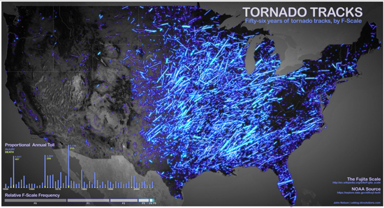
… Read More → "56 years of deadly tornados on one gorgeous map"Assembled from 56 years of NOAA data, this map shows every single (known) tornado that has touched down in the United States in the last 56 years. Each line represents an individual tornado, while the brightness of the line represents its intensity on the “Fujita Scale.”
via Gizmodo