fresh bytes
Subscribe Now

Google Earth satellite images may have discovered new Egyptian pyramids

pyramids.jpeg

People who study Google Satellite images have found curious objects in the images on more than one occasion. People have thought satellite images showed Atlantis, and we’ve seen images in the past that looked to be some sort of giant grid on the ground. A new batch of Google Earth satellite images have unveiled what some are saying are lost Egyptian pyramids.

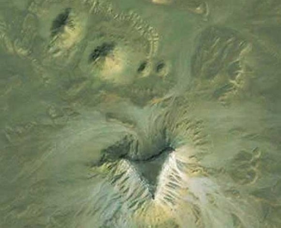
One of the sites is in upper Egypt 12 miles from the city of Abu Sidhum along the Nile River. This site has four different mounds each with a larger triangular-shaped plateau. At this particular site, the two larger amounts are roughly 250 feet wide with a pair of smaller mounds measuring roughly 100 feet in width. The entire complex is arranged in a clear formation with the large mound extending the width of 620 feet, nearly 3 times the size of the Great Pyramid.
via Slash Gear

Continue reading/More photos

Leave a Reply

featured blogs
Feb 18, 2026
Because sometimes the best replacement part'¦ is the one you already have!...

featured chalk talk

Democratizing Centimeter Level GNSS Precision for All Applications
Sponsored by Mouser Electronics and u-blox
In this episode of Chalk Talk, Arnaud Le Lannic from u-blox and Amelia Dalton explore the benefits of the ZED-X20P, all-band high precision GNSS module and the ZED-F20P triple-band high precision GNSS module from u-blox. They also investigate the roles that correction source and centimeter-level positioning services play in these types of designs, and how you can improve your next design with high precision position solutions from u-blox.
Jan 28, 2026
29,030 views