fresh bytes
Subscribe Now

Drone plots a map through uneven terrain, which walking robot then follows

drone-robot-mapping-1.jpg

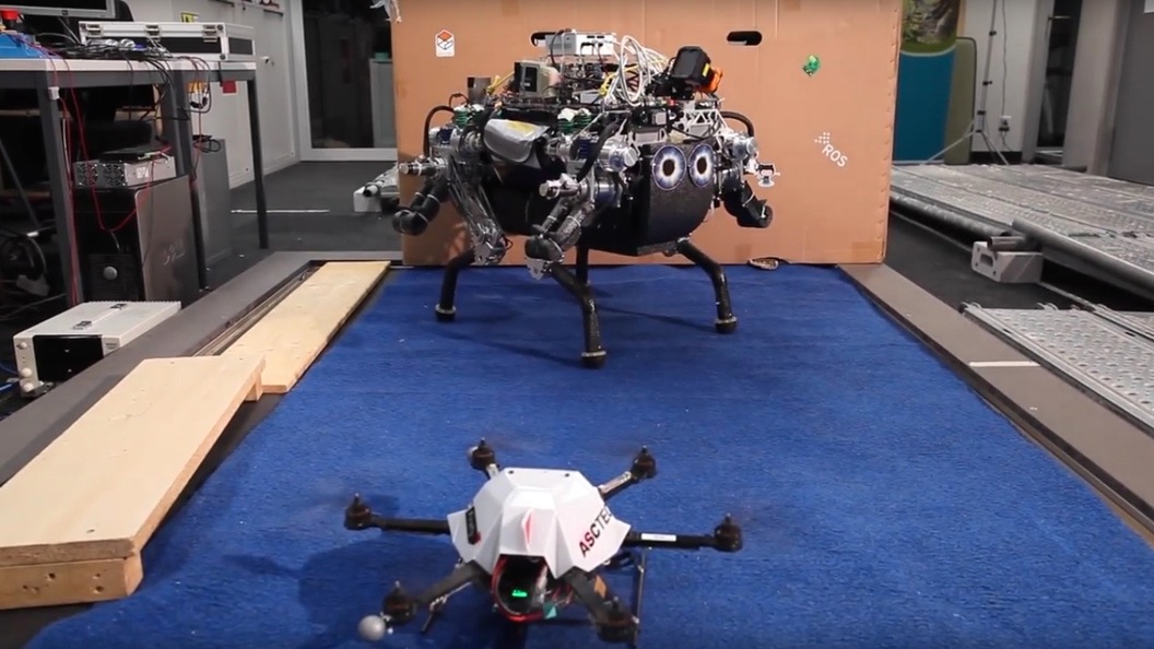
Aerial drones are widely utilized for mapping, with the maps that they create subsequently being used by us humans. In an experiment recently conducted at the ETH Zurich research institute, however, a drone mapped a room so that a quadrupedal robot could then make its way through. Such research could pave the way for completely robotic missions in real-world settings.
via Gizmag

Continue reading

Image: ETH Zurich

Leave a Reply

featured blogs
Feb 6, 2026
In which we meet a super-sized Arduino Uno that is making me drool with desire....

featured chalk talk

Unlocking Cost-Effective and Low-Power Edge AI Solutions
In this episode of Chalk Talk, Miguel Castro from STMicroelectronics and Amelia Dalton explore how you can jump-start the evaluation, prototyping, and design your next edge AI application. They also investigate the details of the cost-effective and lower power edge AI solutions from STMicroelectronics and how the tools, the ecosystem, and STMicroelectronics MCUs are enabling sophisticated AI inference right on the device.
Jan 15, 2026
32,811 views