

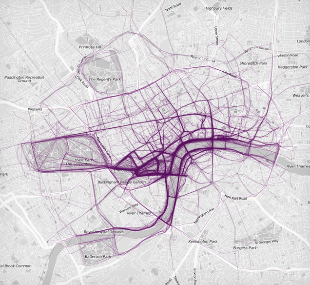
An age of inexpensive wearable devices that track our every move, and having plenty of places to post that information publicly has resulted in a perfect mix of data that shows where people are exercising. Nathan Yau over at Flowing Data has done just that, taking public running logs from RunKeeper and stacking them up over maps of the cities. The result is a collection of maps for 22 cities (most of which are in the US) that shows what routes get the most foot traffic.
The big takeaway, Yau says, is that the most running is happening by water and in park areas.
via The Verge

