

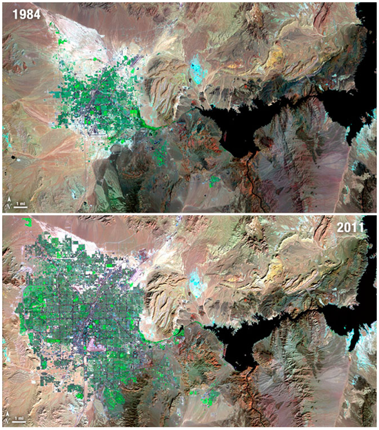
Cities across the globe have seen unprecedented growth in recent decades. While revisiting a city after a period of time can reveal some surprising changes, the true extent of the expansion of some urban centers can only be truly appreciated from above. Way above.
The Landsat satellite program is the longest continuous archive of images of Earth from space in existence. Run by the USGS and NASA since Landsat 1 launched on July 23, 1972, this record of the surface of our planet reveals invaluable insight for scientists and the public alike. A record like this is particularly useful for studying change and understanding the human impact on the landscape.
via Wired
Continue reading/more pictures

